2.1A Overlays and Modal Networks
In addition to the street types, there are overlays and modal networks assigned to specific street segments that influence street design. Prior to designing a capital or private development project, designers should confirm overlays and modal networks by referencing the street type map.
Overlays
Jurisdiction
OverlayJurisdiction identifies the decision-making body for the street segment. Common jurisdictions include the City of Minneapolis, Hennepin County, Minnesota Department of Transportation, Minneapolis Park and Recreation Board (MPRB), and University of Minnesota (U of M). In some case, operations and maintenance responsibilities are delegated from the agency with jurisdictional control to another agency by agreement. Designers should consult maintenance agreements to understand existing responsibilities, and the staff whom negotiate them to check for any likelihood of responsibilities shifting in the near future.
Route
OverlayRoute identifies the appropriate standards required by funding authorities for design, maintenance, or operation of the street. Common route types include Local, Municipal State Aid, County State Aid Highway, and State Trunk Highway. Designers should consult appropriate design standards and rules for the route type, but should be aware that some design standards are not as ideal for a highly-developed urban area like Minneapolis. If the rules conflict with the guidance in the City of Minneapolis Street Design Guide, designers should evaluate the conflicting guidance and consider seeking a variance or design exception with the appropriate jurisdiction. An understanding of appropriate design standards is important to understand early in the design process, as the application process for variances and design exceptions may influence project schedules.
Function Classification
OverlayFunctional classification identifies the role that a street plays in the regional transportation system. The functional classification system is managed by the Metropolitan Council in accordance with Minnesota Department of Transportation and Federal Highway Administration standards. For designers, the functional classification is most relevant to consider when seeking and utilizing federal funding. Functional classifications include: principal arterials, minor arterials, collectors, and local streets.
Snow Emergency Route
OverlaySnow Emergencies are a set of predefined parking regulations that allow crews to completely clear streets of accumulating snow. In order to be plowed completely, streets must be free of parked vehicles. Snow Emergency Routes are streets where the roadway zone is prioritized for snow and ice control after significant winter storm events.
Historic Streets
OverlayHistoric streets are specifically designated streets that may still retain some level of historic character, original historic brick, or cobble paving, or streets that have been reconstructed in more recent times with original or modern pavers to reflect a historic character. Designers should consider the historical character and material choices on historic streets. See historic streets guidance for more details.
Speed Limits
OverlaySpeed limits regulate the maximum speed motor vehicles are allowed to operate to support safety and access. Designers should design streets in a way that supports travel at or below the speed limit. The guidance by street type was created with that goal in mind recognizing that most streets need traffic calming elements to support safe speeds.
Modal Networks
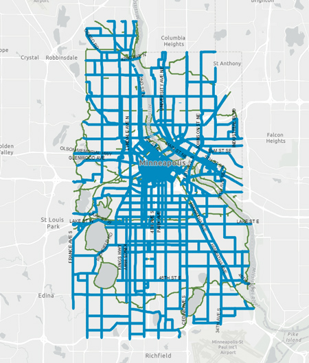
Pedestrian Priority Network
Modal NetworkThe Pedestrian Priority Network is a grid of streets that represent where people most frequently walk and often includes access to transit and commercial and regional destinations. The Pedestrian Priority Network is the focus of planning, design, operations, and maintenance to improve the ease, comfort, and safety of people walking throughout the year. Streets on the Pedestrian Priority Network should typically include wider pedestrian zones, frequent high-quality pedestrian crossings, and more pedestrian-oriented street amenities. Streets not on the Pedestrian Priority Network should be designed with pedestrian needs in mind in accordance with the Complete Streets Policy. The Pedestrian Priority Network most commonly overlaps with Downtown Core, Mixed Use Commercial Connector, Mixed Use Community Connector, Mixed Use Regional Connector, and Urban Neighborhood Connector streets.
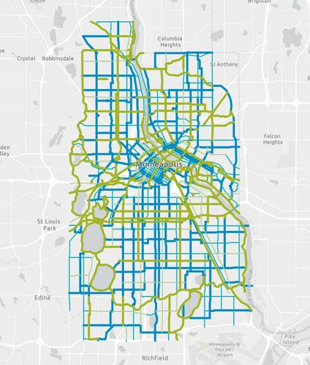
All Ages and Abilities Bikeway Network
Modal NetworkThe All Ages and Abilities bikeway network includes facilities for bicycle and micromobility traffic, including trails, protected bike lanes, and neighborhood greenways. Designers should include an All Ages and Ability bikeway in the design of any street on the network. Designers should evaluate the appropriate bikeway design if the street is not on the All Ages and Abilities Network; bikeways may be included on streets not on the network based on local context, needs, development opportunities, and changing transportation demands. The All Ages and Abilities Network overlaps with nearly all street types.
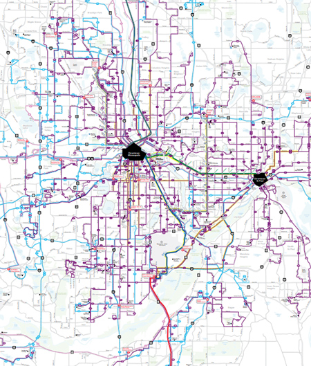
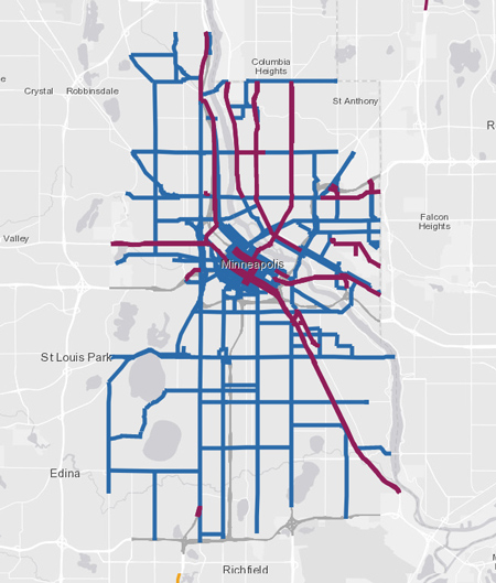
Transit routes
Modal NetworkThe transit system map includes streets where regular route transit occurs, including local bus, express bus, bus rapid transit, and light rail transit routes. Designers should follow transit stop guidance and appropriate lane width guidance for any street with transit service. The transit system most commonly overlaps with Downtown Core, Mixed Use Commercial Connector, Mixed Use Community Connector, Mixed Use Regional Connector, and Urban Neighborhood Connector streets.
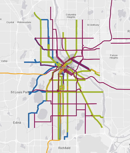
Transit Priority Projects
Modal NetworkTransit Priority Projects identifies corridors to improve frequency and reliability on existing routes and identifies where new services are needed. Designers should consider planned future upgrades to transit service such as arterial bus rapid transit or bus-only lanes. Transit Priority Projects most commonly overlaps with Downtown Core, Mixed Use Commercial Connector, and Mixed Use Regional Connector streets.
Truck Route Network
Modal NetworkThe Truck Route Network includes streets where large trucks are encouraged to operate between the interstate system and local destinations. Per City ordinance, large trucks may operate on non-Truck Route streets for the shortest possible distance to access local destinations. Designers should follow appropriate design vehicle guidance for streets on the Truck Route Network. The Truck Route Network most commonly overlaps with Mixed Use Regional Connector, Mixed Use Commercial Connector, and Downtown Core streets.